Thinking about isolation

This isn’t the post I’d originally intended to write this week, but who of us right now is doing what we thought we’d be doing even at the start of this week, let alone a few weeks ago? As the week has progressed, it has become increasingly difficult to see the relevance of that original idea in the current time and place. So, inspired by the work of a colleague (whose excellent blog post you can see here), I started thinking more about isolation in 19th century Aotearoa New Zealand. What follows  is a very once-over-lightly and rambling consideration about the different types of isolation experienced by the 19th century settlers of Canterbury, thinking about the sites of isolation I have worked on or know about. I’ve not discussed the types of isolation that Māori experienced during the century (although some may well have been the same as the European settlers, but there would also have been many types of isolation caused by colonialism), as I am in no position to do justice to this (but see this).

Truly splendid isolation. The centre of W. T. L. Travers’s station, on Lake Guyon, in what is now the St James Conservation Area, and where W. L. Newcombe lived in the 1860s (NENZC 29/11/1866: 3). It looks isolated, but there was actually someone living about an hour and half’s walk away (NENZC 29/11/1866: 3). Image: Alexander Turnbull Library, PA1-q-247-02.

Isolation actually forms a fairly prominent theme in Aotearoa New Zealand’s historiography, thanks largely to the work of Miles Fairburn (1989). I’ll confess that I’ve not read all of Fairburn, but I think I’ve read enough, and enough about his work, to be able to summarise his arguments reasonably accurately (bearing in mind that a little knowledge is a dangerous thing). I should say, too, that I’m going to focus on what Fairburn had to say about isolation in 19th century Aotearoa New Zealand, not his overall thesis. Fairburn (1989: 173) calculated that, prior to 1991, some 36-47% of the population did not have any physically close neighbours (I would contend that the methods used to generate this figure were not quite as robust as might be desirable – to be fair, it is not easy data to generate). He argued that this physical isolation was compounded by being a significant distance from ‘home’ in a strange country, without family and friends. He went on to argue that this isolation, in conjunction with relatively high levels of land ownership and relatively high levels of what he called transience (basically that people didn’t live in any one place for particularly long), combined to create an atomised society. This society was characterised by weak social bonds and high levels of drunkenness and violence (Belich 1991: 673). Subsequent work has found a more nuanced picture, and his work has been critiqued for not recognising that important social bonds formed in the face of this physical isolation (Ballantyne 2011: 61-62, Belich 1991: 674).

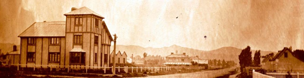
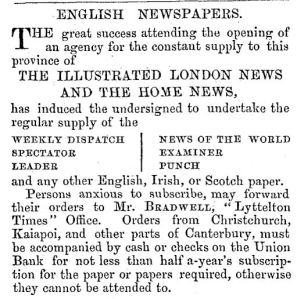
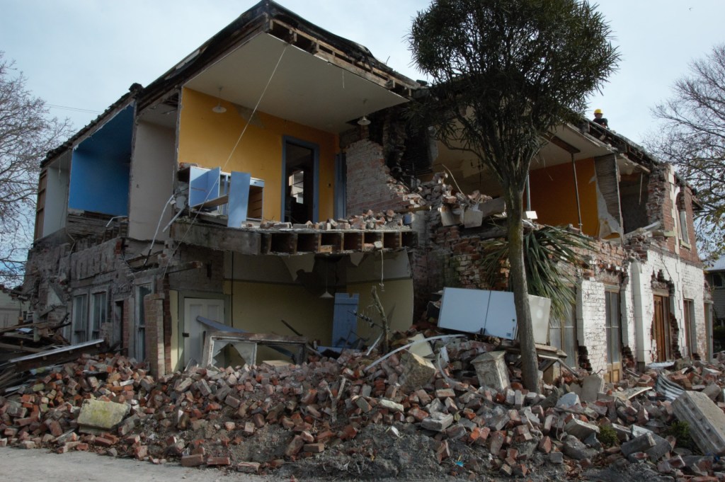
But it remains true that many of Aotearoa New Zealand’s 19th century settlers had left their homes to move to the other end of the world, and many came knowing that they were unlikely to see their family and friends again – I still cannot imagine the leap of faith that requires. Of course, in some cases, family and friends came too: the family of Ernest Oppenheim, who built one of the houses I’m researching, arrived in Christchurch gradually over a ten year period, most of them as adults (DLS 1865, 1872. And while others arrived on their own, they might have been attached to a broader community through religion or country of origin (Fraser 1997). While it was a lengthy boat journey back home, it was by no means impossible: Jessie’s work has found evidence of business owners travelling back to England for business purposes and I have come across families that travelled back simply for a visit. To be fair, this was often a visit of several years and probably the preserve of the wealthy. While it’s not the same, letters appear to have flown back and forth across the oceans, between New Zealand and family members who had not emigrated (Porter and Macdonald 1996: 2). Similarly, this was the age of the telegram, and English newspapers in particular were readily available in New Zealand’s cities, albeit somewhat out of date. All of these would have provided valuable and important connections between those who emigrated and those who did not.

Newspaper from home, wherever that might have been, provided a critical link to the world that many of Aotearoa New Zealand’s 19th century settlers had left behind. New Zealand newspapers printed stories from English and other newspapers, mechanics’ institutes stocked various papers for overseas (Schrader 2016: 133) and subscriptions to these papers were available – our addiction to the news is nothing new! Image: Lyttelton Times 17/4/1858: 5.

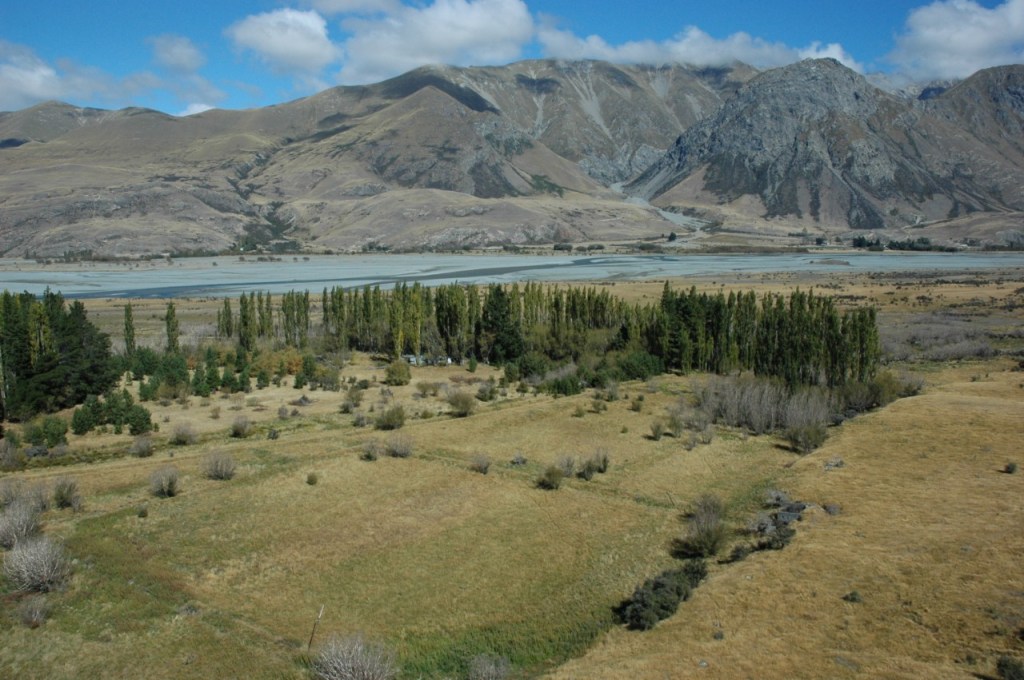
For some settlers, there was also a very real isolation from others, even in this country. Take Mrs McRae, for example, who lived on Stronechrubie station*, way up in the headwaters of the Rangitata River, from about 1878-1892 and apparently went some 10 years without seeing another woman (Acland 1975: 301-302, 304; Brown 1940: 218). Pastoral stations in general lent themselves to isolated communities at least, if not always isolated individuals. The early boundary keepers of Canterbury (who were, as best my research has identified, fairly few and far between), however, would have been much more isolated, as would the occasional shepherds who lived out on the far reaches of the shepherd. These men would have lived on their own year-round, with just occasional visits from other station workers (I honestly don’t know whether wives might have lived with them).

The remains of an 1850s shepherd’s hut on what was then Omarama station (Watson 2010: 4).

While this isolation must have been pretty hard to deal with for some, there were others who actively sought it out. Take for example, Wyndham Barker, who I’ve written about before over here (and here), established an ice rink on the north bank of the Rangitata River in the 1930s, in the lee of Mt Harper. He and his wife, Brenda, lived here year-round – even today, it’s an hour (including a jet boat ride) from the nearest town (Geraldine). And that’s the quickest way to get there. While things would have been busy there in the winter, the Barkers would have lived in splendid isolation in the summer – and the spectacular scenery would have made it quite, quite splendid.

I can think of much worse places to be isolated. But I am a natural introvert and this is pretty much my tūrangawaewae. The ice rink is in the foreground, and Wyndham and Brenda’s house is in the poplars in the middle distance.

For those living in the cities, there was much less obvious isolation, although one of the criticisms levelled at city dwelling is the isolation that can be experienced in spite of being surrounded by so many people. It is difficult to explore this type of isolation archaeologically, however. Perhaps one of the more obvious ways that people would have experienced isolation in Christchurch is through physical and forcible isolation, in either gaol or the asylum. As with the other sites of isolation discussed here, these were sites of both physical and social isolation, but the social isolation in these cases was much more deliberate. The residents of these institutions were being isolated from the rest of society for what was believed to be the benefit of both society and the individual who was being isolated. Reality, of course, may have been very different for all concerned.

One of the buildings that made up the Sunnyside Lunatic Asylum. Image: Te Papa, C.011626.

What I kept thinking about, though, as I wrote this post was that while all these people were isolated, and some in very remote locations, they all remained connected to the world in different ways. At the Sunnyside Lunatic Asylum, in the early years at least, the public were encouraged to attend a range of events at the asylum, including dances, plays, church services and cricket matches (Seager 1987). Station diaries reveal a considerable amount of to-ing and fro-ing between different stations, whether for business or pleasure – there was the seasonal round of the shearing gangs, station employees would often go and carry out work on adjoining properties, and then there were social events, too, in the form of balls and other parties (Barker 1883: 90-91, 98). And I’ve already mentioned the various ways 19th century settlers remained connected to the world they’d left behind. From this I drew two conclusions. One: while life in 19th century New Zealand might seem isolated at first glance, once you start to look into it, it wasn’t. You might not have been able to video chat with your friends from all around the globe over lunch, but expectations were different then. And this connects to my second moral: our connections to people matter. This is stating the obvious, particularly in the current circumstances. But it’s worth remembering here and now that these connections have always mattered, and that our forebears coped with this isolation and that we will too. Humans are resilient and social beings and we will always find ways to connect with others in our isolation.

Sometimes it might take crazy video chats to get you through – and this was only Day 1…

Katharine Watson

*A station (also known as a run) was a large landholding, typically of tens of thousands of acres.


Why buildings archaeology?

Before answering that question, let’s start with what buildings archaeology is. Basically, it’s using archaeological techniques to document standing structures with a whole range of functions, from tramping huts, to houses, to churches, to flour mills, to shops, to libraries, to hotels and even radiation laboratories, along with any other building type you can think of. Like other forms of archaeology, buildings archaeology uses a variety of techniques, such as drawing, photographing, measuring, recording and sampling. More technological methods can be used too, such as dendrochronology, laser scanning and photogrammetry – although these last two are really just achieving the same end as drawing, measuring and photography. And, because of the period of our past that I deal with (mostly the 19th century), I’d like to throw in historical research as an archaeological technique too, because this provides some of the necessary context for interpreting the building – without this, I could not understand the buildings I’m investigating.

The former Christchurch Public Library, built 1875 to a design by William Armson. Arguably the most beautiful building I recorded post-earthquake. Image: K. Watson.

To me, buildings archaeology is essentially breaking down a building into its individual components, recording all the details of those – form, fabric, dimensions, how it was made or shaped, its location in the building – in order to understand how that building was constructed and how it has changed over time. The building components I’m referring to are things like the foundations, the bricks, the nails, the wallpapers, the skirting boards, the architraves, the window surrounds, the windows themselves, the doors, the roofing material, the floorboards, the nature of the joinery – you get the picture. As well as recording all these individual details, buildings archaeologists also record the form of the building as a whole, through floor plans, elevation drawings, cross-sections and foundation plans.

A house in Avonside Drive, built in c.1897 by T. N. Horsley, local businessman and politician. Image: L. Tremlett.

So why do archaeologists record buildings in this way? What can we learn from doing this? Lots, is the short answer. Buildings, obviously, were not constructed in a vacuum. The construction techniques and building materials used, the external appearance of the building and its internal layout, even its overall form and shape, reflect the economic, social and political context in which it was built – so while it’s essential to understand as much of that context as possible to understand a building, a building can in turn be used to better understand that context (Johnson 2010). Take for example, the recent trend for tiny houses, which, in New Zealand at least, are a response to the current housing crisis, which has seen houses become increasingly expensive. They also, perhaps, represent an increasing desire for a more minimalist way of life, to avoid clutter and owning so many ‘things’. And, for some, they represent a desire for a more environmentally friendly way of life. In some ways, they can be seen as somewhat anti-capitalist. This context, and these broader social movements, help us understand why tiny houses are being built here and now. A detailed analysis of the form and fabric of these houses would shed light on what particular individuals value through what they’ve chosen to build their tiny house from, what they’ve chosen to include in it and, just as importantly, what they’ve chosen to exclude.

There’s a lot that buildings archaeology can tell us about building materials and techniques, which can tell us about the surrounding environment, about trade patterns and about local industry. These things can also be really helpful when trying to work out when a building was built, or when specific changes were made. Examining building techniques and materials can also tell us if a building was built cheaply – or if no expense was spared. Building layout can tell us about social relations, about how space was gendered, about how access to space was restricted to and by different groups, or about how people moved through buildings, and how this relates to broader social patterns. Servants’ stairs are a classic example of the latter, and the hall arch that separated public and private spaces in Victorian era houses is a good example of how access to space was controlled. Like so much archaeology of the recent past, buildings archaeology can shed light on the lives of the marginalised. And it is likely, too, that it can answer questions about homelessness in the past, although it does not at first glance seem well positioned to do so.

A house in Waltham, Christchurch, built with double brick walls, but the internal skin of bricks has been laid stretcher to stretcher, rather than bed to bed, which would have used fewer bricks than building in the standard manner (Hennessey and Watson 2013). Image: Hawkins Construction.

But I am most interested – at the moment – in buildings as material culture, in the premise that houses in particular say something about the people who built, owned and lived in them (and, while my focus is on houses here, the same can be said of any building – basically, buildings say things about people). I regularly trot out the line that we judge the occupants of a house by its appearance in the same way we judge a person based on their appearance – it’s no less true for the frequency with which I say it. Our understanding of houses and our ability to appraise them in this way comes from having an innate sense of what the different features of a house ‘mean’ – or at least, how they’re interpreted by the society in which they were built (and remain standing) – so long as we understand that context. And that’s the kind of understanding that can come simply from living somewhere, from knowing a place well. It’s important to keep in mind that meanings change. They change with time and place. They change as political and social ideas change. And they might change with the people who own or occupy the house, or as the house itself changes. Again, context is everything.

In New Zealand, buildings are protected in much the same way as below ground archaeological sites, in that the Heritage New Zealand Pouhere Taonga Act 2014 requires you to have an archaeological authority if you are demolishing a building built prior to 1900 (unlike below ground archaeological sites, buildings are not protected from damage or modification). That archaeological authority will typically require recording of the building prior to and during demolition. And that’s where the sample of houses I’m using for my PhD research comes from. Actually, it’s a bit more specific than that: the 101 buildings in my sample were all demolished between February 2011 and June 2015 under the provisions of what was then the Historic Places Act, as a result of earthquake damage. They were all in Christchurch, and all were built prior to 1900.

This context – yes, that word again – is important for a number of reasons, both for this blog and my research. The rapidly increasing word count of this post means I’m only going to deal with the former here (although there is some overlap) – the latter will no doubt come up in due course. In the first instance, the earthquake context means that there will be photographs of buildings that collapsed to some extent or were badly damaged in the earthquakes, in ways that meant that certain parts of some buildings could not be accessed, or in ways that meant perfect photographs of façades were not possible (those, to be honest, are made pretty difficult by a number of factors, hence the importance of elevation drawings). The other consequence that I’m acutely conscious of is that it means that most of the photographs were not taken by me, and none of the elevations or floor plan were drawn by me. Instead, these images were created by people who working for me at the time. Some of the photographs, too, were taken in the early days after the earthquakes, when I was contracted to Heritage New Zealand Pouhere Taonga (HNZPT) to take photographs of listed and/or pre-1900 buildings that were being demolished. So that’s why you’ll see other people, or HNZPT, credited with a number of the images that appear. It’s also why you’ll see other people credited for the interpretation of the building, whether here or on our social media channels.

A partly collapsed house that I recorded following the earthquakes. Image: Heritage New Zealand Pouhere Taonga.

There you have it! A very brief introduction to the whys and wherefores of buildings archaeology. Like any form of archaeology, it’s another way of learning more about the past, and people in the past, through tangible objects, through detailed recording and, a point somewhat belaboured in this post, through understanding context. Buildings are a different dimension through which to investigate the archaeological record, and enhance our understanding of the lives of those who created that record.


References

Hennessey, Matthew and Katharine Watson, 2013. 6 Short Street, Christchurch: report on archaeological monitoring. Unpublished report for Hawkins Construction.

Johnson, Matthew, 2010. English Houses 1300-1800: Vernacular Architecture, Social Life. London: Routledge Ltd.

Musings on a conference

A conference like the recent Society for Historical Archaeology (SHA) one in Boston can be pretty overwhelming – it’s attended by 1200 people and there are multiple concurrent sessions. Even perusing the lists of papers and all the abstracts can take some serious time, not to mention actually deciding which papers to go to, and working out whether it’s better to attend one whole session (my preference) or to duck from session to session to catch particular individual papers (which I find a bit exhausting!). And there’s almost constant FOMO, not to mention the complete inability to think straight that comes after a full day of listening to papers. But it’s a fantastic opportunity to be able to hear archaeologists from all around the world talk about an incredible diversity of topics, to meet new people, to hear about different approaches and new theories and learn about different places. Such as Iceland. I learnt a lot about Icelandic archaeology this year – not directly relevant to my own work, but still entirely fascinating. Such as the story of a feud between two villages that lasted something like a thousand years (no, that’s not a typo) and the way this played out in the different ceramics they used, with one village using significantly more ‘modern’ ceramics than the other, in spite of the two being pretty geographically close.

One of great things about SHA is the chance to hear a whole lot of ideas that I wouldn’t otherwise be exposed to. So this year I attended a session on archaeology as social activism, another about the politics and memorials, one about queering archaeology (including possible evidence of cross-dressing from early 20th century Washington D.C.), another (Jessie’s session!) about the archaeology of retail and a rather lovely session all about unusual ceramics found on American archaeological sites that was perfect first thing on a Saturday morning. This included a fascinating paper about Mary Washington (George’s mother…) and how she used ceramics to keep up appearances following the death of her husband, which left her with five children and in somewhat reduced circumstances at Ferry Farm, Virginia. Archaeologists working there have found evidence of homemade glues being used to repair ceramic dishes – once repaired, these dishes would not have been watertight, but could still have been used as display pieces. Rather fantastically, the presenters described Mary as having “a strong tea game”, in an era when hosting guests for tea was an important social ritual.

The replica of Mary Washington’s house built at Ferry Farm. Image: Wikipedia.

Buildings archaeology doesn’t loom large at the SHA conference and there were just a handful of papers that really focused on buildings as archaeological sites, although quite a few others that mentioned buildings along the way, including one about what the presenter called “ghosts in the walls”, another phrase I loved. This was about deposits deliberately hidden around the doors and windows – the “liminal spaces” – of Bacon’s Castle, a c.1665 building in Virginia, perhaps by slaves. These objects included a shoe that had deliberately been cut in half, along with more mundane bottles and fragments of glass.

Bacon’s Castle, the oldest surviving brick building in North America, built by Arthur Allen. Image: Wikipedia.

Two papers were much more explicitly about buildings archaeology (there was a third, but it was on at the same time as one of the other two). Sarah Breiter looked at the building materials used in houses in Bury St Edmunds in Suffolk in the 14th and 15th centuries while Chris King looked at the similarities and differences between merchants’ houses in Norwich and New England in the 17th century. Sarah Breiter’s paper considered the “entanglements” of the building materials used, and how these building materials reflected what else was going on in that particular time and place – such as the dissolution of the monasteries, or how oak forests were being managed, or how certain people might have controlled access to a particular resource. The basic premise of this paper was that you cannot understand a building properly unless you understand what it was built from and, more importantly, why, because the availability of building materials was governed by the social, environmental, political and economic context in which the building was built.

Chris King’s paper examined the use of merchant’s houses in 16th and 17th century Norwich as civic spaces, explaining how merchants used and decorated them to help in their quest for local political power, not just for themselves but for their families as a whole. What perhaps intrigued me most about this paper was his comparison of these houses with the merchants’ houses of New England, and how these houses in fact have parallels with Protestant meeting houses in Europe. These parallels can be linked to their shared Protestant beliefs. The other fascinating element was that, when the Puritans arrived in New England, they built houses with what was, for the time, a relatively new, modern layout, but with an exterior that was somewhat out of date, with prominent gables and jettied first floors. My own work means that I’m particularly curious about what people build in a colonial setting and how that relates to where they’ve come from – and what it says about how these people saw their place in the world. New Zealand’s British settlers, for example, largely retained a typically British layout, but what they did with the exterior of their houses depended a lot on when they arrived, and varied from person to person.

Pettus House, Norwich. Image: Wikipedia.

What I love about going to SHA is not just the diversity of papers and topics covered (I’ve barely scratched the surface here), but the political nature of so many of these papers. So many papers deal with power imbalances in society, whether that’s in relation to gender, ethnicity, class or status, etc, and they discuss this in quite explicit ways. Some of these power imbalances are in the past, but others are in the way archaeology is carried out today – for example, the powerful keynote presentation from Whitney Battle-Baptiste, exhorting us all to read more work by black female archaeologists, which led me to think about my own reading. It’s not something we do a lot of in Aotearoa, in part because there’s currently no historical or modern world archaeology academic position here and in part because so much modern world archaeology gets carried out in a commercial setting (where there is little time or money for carrying out detailed research, and where you don’t get to choose the sites you’re working on, so you can’t select a site to try and answer a particular research question). Historical archaeology, as has been acknowledged almost since the discipline’s development, has a particular power to reveal the stories of the marginalised, but it’s also important to be conscious of our own privilege in carrying out this work.

With thanks to the UC Doctoral Overseas Travel Scholarship, which enabled me to attend this conference.

Katharine