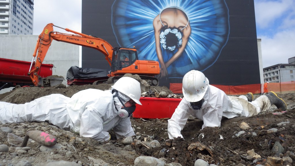
On 21 February 2011, Ōtautahi/Christchurch and Ōhinehou/Lyttelton were struck by a devastating earthquake.[1] 185 people were killed, thousands of buildings badly damaged or destroyed and the city was changed forever. Out of all the destruction and rebuilding came a considerable amount of archaeological work, largely as a result of the Heritage New Zealand Pouhere Taonga Act 2014. This act, administered by Heritage New Zealand Pouhere Taonga, protects all archaeological sites in New Zealand that were formed before 1900 (more about it here). This archaeological work took place when buildings were demolished, when building foundations were being removed, when there were earthworks for new builds and during the earthworks to repair and replace damaged infrastructure. Ōtautahi Christchurch has been the site of human occupation since at least the 14th century, much of it concentrated in the areas most heavily affected by the earthquakes (the coast and the CBD). That time depth, in combination with the earthquakes, has resulted in an incredible archaeological resource for the area.
Oral history and archaeology tell us that Māori occupation of Ōtautahi/Christchurch and Ōhinehou/Lyttelton was concentrated at Rāpaki, Raekura/Redcliffs, Matuku-takotako/Sumner, Puāri and Ōtautahi (both on the banks of the Ōtākaro/Avon River in what is now the central city). The many sites of significance are a testament to the wealth of resources of Ōhinehou and Ōtautahi. Te Rūnanga o Ngāi Tahu have undertaken a fairly amazing cultural mapping exercise that documents and highlights the rich heritage of the South Island and we highly recommend checking it out. Other fantastic sources about Māori use and occupation of Ōtautahi Christchurch and Ōhinehou Lyttelton are Tī Kōuka Whenua and the Ngāi Tahu Grand Narratives prepared for the anchor projects that formed part of the city’s rebuild. We won’t be writing much about the Māori occupation of the city and its surrounds in the course of this blog, as it’s not what our research is focused on, but the above links are an excellent place to look if you’re interested.
The first Europeans to arrive in the wider Canterbury region, particularly on Horomaka Banks Peninsula, were brought here by the whaling industry in the early 19th century. This was followed by the signing of Te Tiriti o Waitangi in 1840 and Henry Tacy Kemp’s 1848 purchase of approximately 13.5 million acres of land from sixteen Ngāi Tahu chiefs, for £2000, in 1848. As part of the purchase, reserves were to be set aside for Ngāi Tahu, along with their mahinga kai areas, and schools and hospitals were provided for. In the end, the reserves that were set aside were too small to serve their purpose adequately, and ‘mahinga kai’ was interpreted as relating to gardens only (Te Rūnanga o Ngāi Tahu 1997). Between them, Te Tiriti and the Kemp purchase paved the way for the European settlement of what is now Canterbury, and the formation of Ōtautahi Christchurch and Ōhinehou Lyttelton.
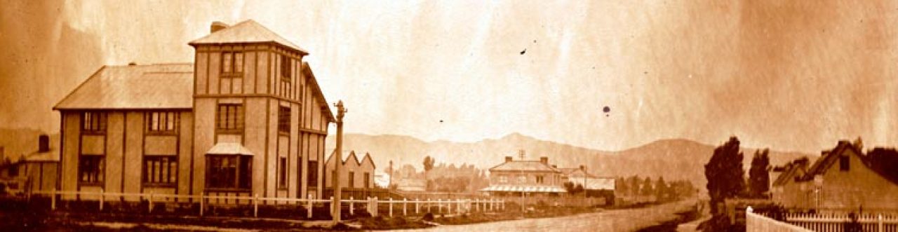
Canterbury, Christchurch and Lyttelton were the result of the utopian visions of the Canterbury Association, who somewhat infamously wanted to recreate a pre-industrial England in Aotearoa New Zealand. Christchurch’s ‘founding’ is generally regarded as dating to 1850, when the first of the paying settlers arrived at the infant settlement of Lyttelton. Employees of the association had in fact arrived prior to this and were responsible for preparing for the new colony and establishing the towns of Lyttelton and Christchurch. From here, both towns continued to grow. We’re not going to outline any more of their histories here, because hopefully the blog will flesh out these details! But if you’re after more detail immediately, here’s an excellent history of Lyttelton and one of Christchurch.
So, where do we come into the picture? Well, Katharine had been working as an archaeological consultant in Christchurch since 2000, running the company she formed – Underground Overground Archaeology – from 2006 (she sold the company in 2017). Jessie joined the team there as an artefact specialist in 2012. During the craziness of the post-earthquake work, we decided to establish a blog (Christchurch uncovered – which continues today and we highly recommend you check it out) to share the stories and sites we were uncovering. Then we both moved on to our PhDs and discovered that we missed sharing these things with people. So here we are again…
We intend to post on this blog fortnightly and reserve the right to ramble at length about many, many things, not all of them related to our research. There’ll be posts about Christchurch and about archaeology (obvs), and sometimes things will get theoretical (we’re PhD candidates, after all), we’re bound to talk about identity, we’ll probably be quite flippant, and sometimes we’ll just post pictures of interesting things (Jessie: artefacts, Katharine: houses), because, well, they’re interesting – and deadlines are always a struggle…
References
Te Rūnanga o Ngāi Tahu, 1997. Kemp’s Deed, 1848. Available at: https://ngaitahu.iwi.nz/our_stories/kemps-deed-1848/ Accessed 17 December 2019.
[1] The earthquakes, of course, affected a much broader area, but these are the urban centres that are the focus of our work.
